|
|
|
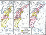
| Maps > United States > Early America 1400-1800 |
A collection of historic maps of early America from explorations and settlements of the English, French, and Spanish, to the end of the American Revolutionary War.
|
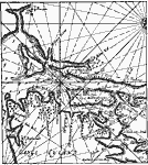
New York and vicinity,
1666 |
|
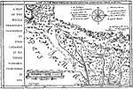
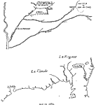
Sir John Lederer's Marches,
1672 |
|
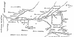
Mississippi Valley,
1672–1673 |
|
New Jersey,
1674–1702 |
|
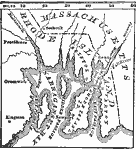
King Philip's War,
1675–1676 |
|
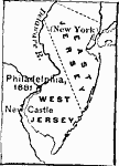
The Two Jerseys,
1676–1702 |
|
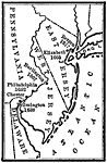
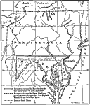
Boundary Dispute between Maryland and Pennsylvania,
1681–1767 |
|
Mississippi Valley,
1682 |
|
Types of Colonial Governments,
1682–1730 |
|
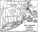
Early Settlements in New England and Distribution of the Indian Tribes,
1686 |
| First | Previous | Next | Last |
| Maps > United States > Early America 1400-1800 |
Maps ETC is a part of the Educational Technology Clearinghouse
Produced by the Florida Center for Instructional Technology © 2009
College of Education, University of South Florida