Maps Site map
  Maps > United States > Early America 1400-1800
Site Map  

  Record   91   to   100  of   199

A collection of historic maps of early America from explorations and settlements of the English, French, and Spanish, to the end of the American Revolutionary War.
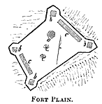
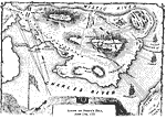
Fort Plain, 1770s
A plan of Fort Plain, New York, constructed in 1776 during the American Revolutionary War. Explanation of diagram: The black line represents the parapet; (a) the large block–house; (b) small block–houses at each bastion; and (c) barracks....

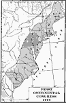
First Continental Congress, 1774
A map of the British Colonies showing the colonies participating in the First Continental Congress of 1774 held in Philadelphia. The map shows the number of delegates from each of the twelve colonies that participated (the Province of Georgia did not...

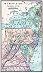
The American Revolution in the the Middle States, 1774–1783
A map of America's middle states during the time of the American Revolution, including New York, Pennsylvania, New Jersey, Delaware, Maryland, and part of Virginia and North Carolina. The map shows major cities, towns, forts, battle sites, mountain s...

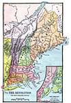
The Revolution in the New England States, 1774–1783
A map of America's New England states during the time of the American Revolution, including Maine, New Hampshire (with Vermont), Massachusetts, Rhode Island, Connecticut, and Long Island. The map shows major cities, towns, forts, battle sites, mounta...

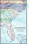
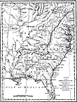
The Revolution in the Southern States, 1774–1783
A map of America's southern states during the time of the American Revolution, including North Carolina, South Carolina, and Georgia. The map shows major cities, towns, forts, battle sites, mountain systems, rivers, and coastal features of the region...

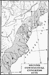
Second Continental Congress, 1775
A map of the thirteen colonies during the Second Continental Congress held in Philadelphia in 1775, showing the number of delegates from each of the colonies....

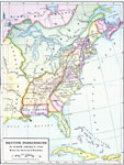
British Possessions in North America, 1775
A map showing the British possessions in North America in 1775, before the outbreak of hostilities during the American Revolutionary War. The map shows the boundaries of the British Colonies along the Atlantic, the Proclamation Line of 1763 after the...

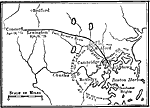
The Siege of Boston, 1775
A sketch map of the area between Boston and Concord, Massachusetts, showing the events leading up to the Battle of Bunker Hill (June 17, 1775). The map shows the route of Paul Revere from Boston to Concord to warn of the approach of the British (Apri...

Action on Breed's Hill, 1775
A detail map of the Charlestown peninsula in Boston Harbor, showing the American and British positions at the Battle of Bunker Hill (actually Breed's Hill), June 17, 1775. The map shows the breastworks and redoubt built by the Americans, and shows th...

The Indian Nations, 1775
An early map of the eastern North America from the Great Lakes to the Gulf of Mexico and east of the Mississippi River around 17765, showing the Indian Nations adjoining to the Mississippi, West and East Florida, Georgia, South and North Carolina and...

First Previous Next Last


  Maps > United States > Early America 1400-1800
Site Map  

Maps ETC is a part of the Educational Technology Clearinghouse
Produced by the Florida Center for Instructional Technology © 2009
College of Education, University of South Florida