|
|
|
| Maps > United States > Growth of Nation |
A collection of historic maps of territorial acquisitions and growth of the United States for use in the K-12 classroom.
|
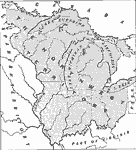
The Northwest Territory,
1787 |
|
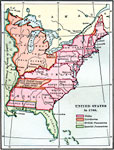
United States,
1789 |

|
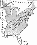
The Development of the Northwest Territory in the United States,
1790–1810 |
|
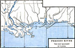
The Perdido River,
1790–1842 |
|
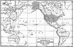
Development of American Interests in the Pacific,
1791–1903 |

|
Oregon Controversy,
1792–1846 |
|
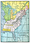
The United States Before the Louisiana Purchase,
1800 |
|
The United States,
1800 |
|
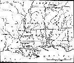
Southern States along the Gulf of Mexico,
1800–1820 |

|
United States,
1801 |
| First | Previous | Next | Last |
| Maps > United States > Growth of Nation |
Maps ETC is a part of the Educational Technology Clearinghouse
Produced by the Florida Center for Instructional Technology © 2009
College of Education, University of South Florida