|
|
|
| Maps > United States > Meteorology |
A collection of meteorological maps of the United States, including mean annual temperature maps, precipitation records and distribution, and typical storm event patterns.
|
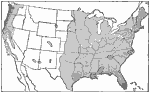
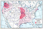
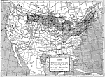
Rainfall in the United states,
1921 |
|
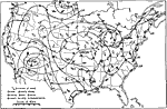
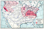
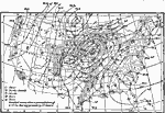
United States Weather,
1921 |
|
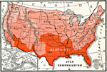
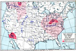
Temperatures in the United States,
6/30/1902 |
|
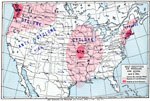
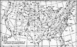
Air Pressure and Winds in the United States,
April 5, 1901 |
|
Temperature, Cloudiness, and Rainfall in the United States,
April 5, 1901 |
|
Air Pressure and Winds in the United States,
April 6, 1901 |
|
Temperature, Cloudiness, and Rainfall in the United States,
April 6, 1901 |
|
United States Weather,
August 20, 1893 |
|
United States Weather,
December 24, 1893 |
|
Low Pressure System,
February 4, 1889 |
| First | Previous | Next | Last |
| Maps > United States > Meteorology |
Maps ETC is a part of the Educational Technology Clearinghouse
Produced by the Florida Center for Instructional Technology © 2009
College of Education, University of South Florida