|
|
|
| Maps > United States > Tennessee |
A collection of historic and contemporary political and physical maps of Tennessee, including Civil War battle plans, for use in the K-12 classroom.
|
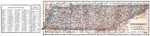
Tennessee,
1914 |
|
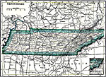
Tennessee,
1919 |
|
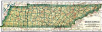
Tennessee,
1919 |
|
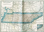
Tennessee,
1922 |
|
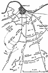
Battle of Nashville,
December 1864 |

|
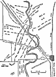
Vicinity of Chattanooga,
December 24, 1863 |
|
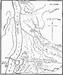
Battle of Stone's River or Battle of Murfreesboro,
December 31, 1862 |
|
Ft. Henry,
February 6, 1862 |
| First | Previous |
| Maps > United States > Tennessee |
Maps ETC is a part of the Educational Technology Clearinghouse
Produced by the Florida Center for Instructional Technology © 2009
College of Education, University of South Florida