| Maps > United States > Utah |
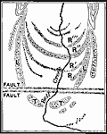 | Bell Canyon, A sketch map of morainic ridges near the mouth of Bell Canyon, Wasatch Mountains. |
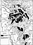 | Former Glacier Systems of the Wasatch Mountains, A map showing the distribution of glacial formations in part of Utah. |
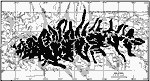 | Uinta Glacier Systems, A map showing the glacier systems of the Uinta Mountains in the Pleistocene. Solid black represents area covered by later glaciers, solid black and dotted represent area covered by earlier glaciers. |
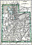 | Utah, A map of Utah in 1919, showing cities and railroad routes. |
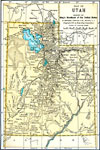 | Utah, A map of Utah from 1891. |
| Maps > United States > Utah |
Maps is a part of the Educational Technology Clearinghouse
Produced by the Florida Center for Instructional Technology © 2007
College of Education, University of South Florida