|
|
|
| Maps > United States > Virginia |
A collection of historic and contemporary political and physical maps of Virginia, including early exploration and settlement maps, Revolutionary War maps, and American Civil War maps.
|
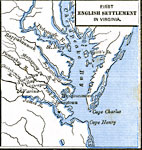
First English Settlement in Virginia,
1492–1620 |

|
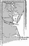
White's Old Virginia,
1585 |
|
Jamestown,
1609 |

|
Smith's Map of Virginia,
1612 |

|
De Laet's Map of Virginia,
1630 |
|
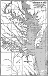
Virginia,
1652 |

|
Yorktown,
1781 |
|
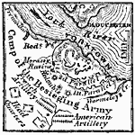
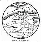
Siege of Yorktown,
1781 |
|
Siege of Yorktown,
1781 |

|
Siege of Yorktown,
1781 |
| Next | Last |
| Maps > United States > Virginia |
Maps ETC is a part of the Educational Technology Clearinghouse
Produced by the Florida Center for Instructional Technology © 2009
College of Education, University of South Florida