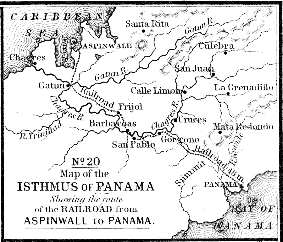
Description: A map from 1858 of the Isthmus of Panama showing the 48 mile route of the railroad line between Aspinwall on the Caribbean and Panama on the Pacific. This is proposed site of the Panama Canal. The map shows towns along the route, and rivers, terrain, and coastal features of the area.
Place Names: Panama Canal Zone, Panama, �Aspinwall, Barbacoas, Gatun, Chagres, Gorgono, Cruces, Frijol, Mata Redondo, La Grenadill
ISO Topic Categories: inlandWaters,
location,
oceans,
transportation
Keywords: Detail of the Isthmus of Panama, physical, �transportation, physical features, railroads, inlandWaters,
location,
oceans,
transportation, Unknown, 1858
Source: , Mitchell's School Atlas (Philadelphia, PA : E. H. Butler & Co., 1863)
Map Credit: Courtesy the private collection of Roy Winkelman |
|