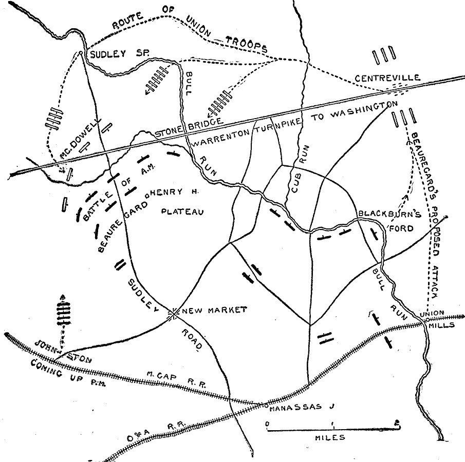
Description: A map of the area around Manassas and New Market, Virginia, showing the operations of the First Battle of Bull Run (also known as the First Battle of Manassas) on July 21, 1861. The map shows Warrenton Turnpike, Bull Run Creek, roads and railways, and the positions and movements of the Union and Confederate armies over the course of the battle.
Place Names: Civil War, Manassa, New Market, Bull Run, Blackburn's Ford, Centreville, Stone Bridge, Sudley Road, Johnston, Union Mills, Warrenton Turnpike to Washingto
ISO Topic Categories: inlandWaters,
location,
transportation
Keywords: The First Battle of Bull Run, physical, �transportation, �historical, �battle of bull run, battle of manassas, first major battle of civil war, kBattle, physical features, railroads,
roads, Civil War, inlandWaters,
location,
transportation, Unknown, July 21, 1861
Source: Theodore Ayrault Dodge, A Bird's-Eye View of our Civil War (Boston, MA: Houghton, Mifflin and Company, 1897) 17
Map Credit: Courtesy the private collection of Roy Winkelman |
|