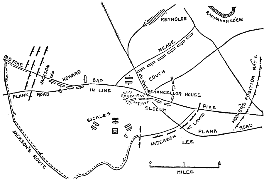
Description: A map of the vicinity of Chancellorville, site of the Battle of Chancellorsville in the American Civil War. May 2 shown.
Place Names: Civil War, Chancellor House, Jackson's Route, Plank Road, Old Pik
ISO Topic Categories: transportation,
location,
inlandWaters
Keywords: Chancellorsville, physical, �political, �transportation, �historical, �jackson's route, jackson, howard, gap, reynolds, meade, couch, fairview, slocum, anderson, mclaws, kBattle, physical features, roads,
railroads, Civil War, transportation,
location,
inlandWaters, Unknown, May 2, 1863
Source: Theodore Ayrault Dodge, A Bird's-Eye View of our Civil War (Boston, MA: Houghton, Mifflin and Company, 1897) 129
Map Credit: Courtesy the private collection of Roy Winkelman |
|