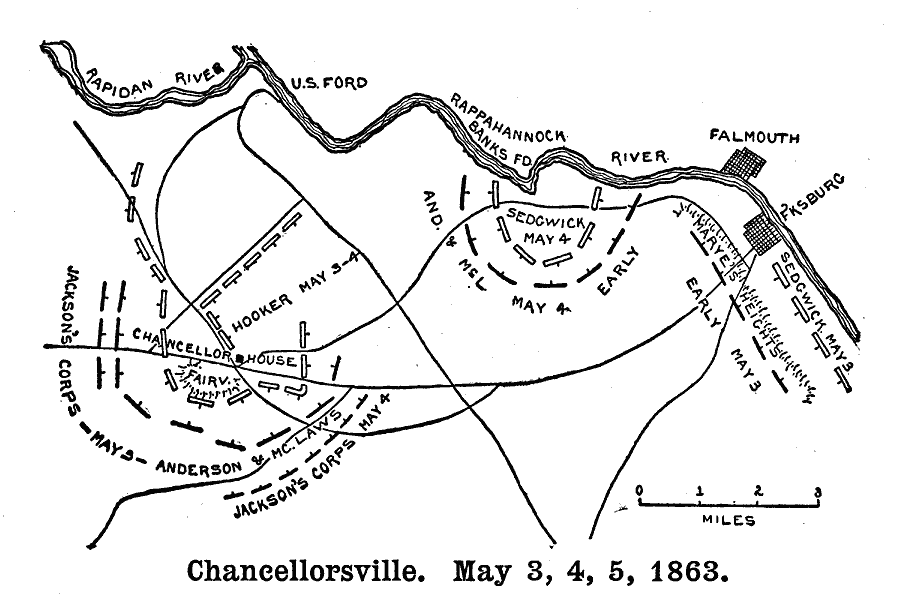
Description: A map of the vicinity of Chancellorville, site of the Battle of Chancellorsville in the American Civil War. May 3, 4, 5 shown.
Place Names: Civil War, Chancellor House, Fairview, Rapidan River, Rappahannock River, Falmouth, Fredericksburg, Fkburg, Marye's Height
ISO Topic Categories: transportation,
location,
inlandWaters
Keywords: Chancellorsville, physical, �political, �transportation, �historical, �jackson's corps, mays, anderson, mclaws, hooker, sedgwick, kBattle, physical features, roads, Civil War, transportation,
location,
inlandWaters, Unknown, May 1863
Source: Theodore Ayrault Dodge, A Bird's-Eye View of our Civil War (Boston, MA: Houghton, Mifflin and Company, 1897) 130
Map Credit: Courtesy the private collection of Roy Winkelman |
|