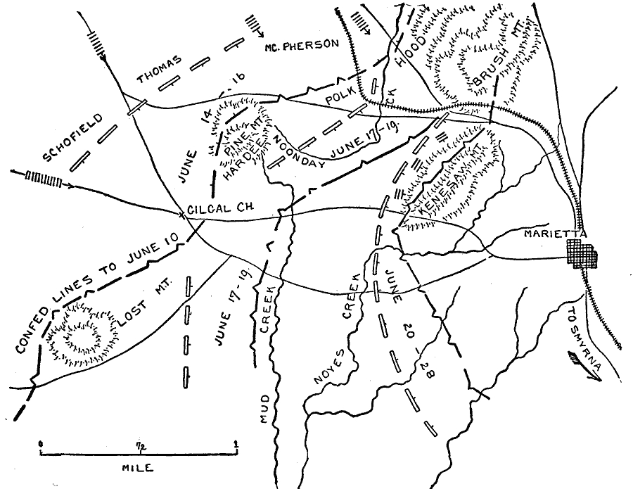
Description: A map of Marietta and vicinity during the Atlanta Campaign of the American Civil War (June 14–28, 1864). The map shows the positions of the Union and Confederate armies, and the sites of the Battle of Pine Mountain (June 14), the Battle of Gigal Church (June 15), Kolb's Farm (June 22), and the Battle of Kennesaw Mountain (June 27).
Place Names: Georgia, Marietta, Noyes Creek, Mud Creek, Lost Mountain, Cigal Church, Kenesaw Mountain, Brush Mountain, Pine Mountai
ISO Topic Categories: inlandWaters,
location,
transportation
Keywords: Operations about Marietta, physical, �political, �historical, �transportation, �american civil war, hood, hardee, schofield, thomas, mcpherson, polk, operations about marietta, kBattle, physical features, roads,
railroads, Civil War, inlandWaters,
location,
transportation, Unknown, June 14–28, 1864
Source: Theodore Ayrault Dodge, A Bird's-Eye View of our Civil War (Boston, MA: Houghton, Mifflin and Company, 1897) 237
Map Credit: Courtesy the private collection of Roy Winkelman |
|