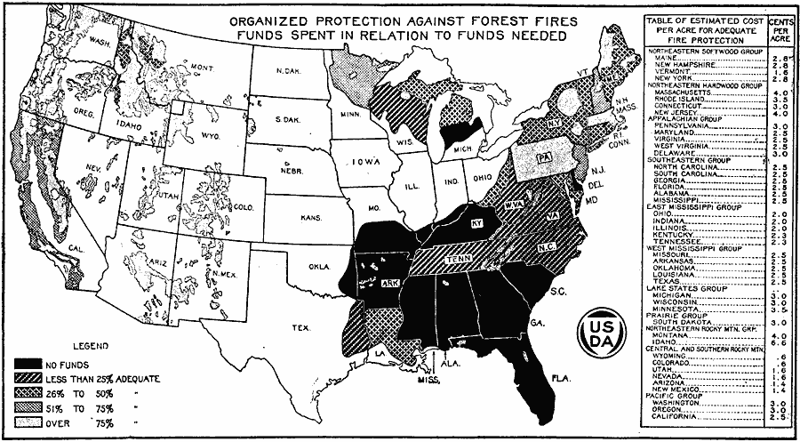
Description: A map of the United States from the U. S. Department of Agriculture (1922) showing the funds distribution at the time dedicated to forest fire prevention compared to the funds needed to adequately protect forest land. The map shows areas where no funding is available, and areas of adequate funding from less than 25 per cent to over 75 per cent.
Place Names: Forestry,
ISO Topic Categories: boundaries,
inlandWaters,
oceans,
location,
economy
Keywords: Organized Protection Against Forest Fires, physical, �political, �statistical, �organized protection against forest fires, forest area protection, funds spent in relation to funds needed, physical features, country borders,
major political subdivisions, economic, boundaries,
inlandWaters,
oceans,
location,
economy, Unknown, 1922
Source: , United States Department of Agriculture Yearbook 1922 (Washington, DC: Government Printing Office, 1923) 160
Map Credit: Courtesy the private collection of Roy Winkelman |
|