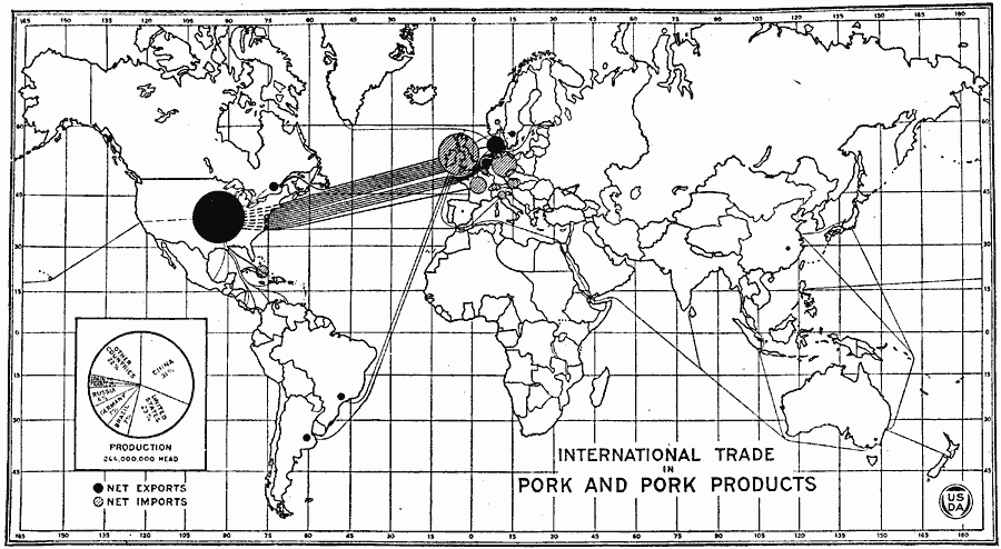
Description: A map from the United States Department of Agriculture from 1922 showing the international trade in pork and pork products. This map shows net exporting countries with a solid black circle, and net importing countries with a shaded circle. The size of each circle on this map represents the relative volume of import/export for the country. Solid lines represent the trade between origin and market. A pie–chart shows the percentages, by country, of the world's pork production (244,000,000 head). According to this map, the United States produced 23 percent of the world's pork and pork products at the time.
Place Names: A Complete Map of Globes and Multi-continent, Africa, �Asia, �Australia, �Europe, �North America, �South Americ
ISO Topic Categories: boundaries,
economy,
inlandWaters,
oceans
Keywords: International Trade in Pork and Pork Products, physical, �political, �statistical, �international pork trade between countries, bacon market denmark sweden, kAgriculture, physical features, country borders, economic, boundaries,
economy,
inlandWaters,
oceans, Unknown, 1922
Source: , United States Department of Agriculture Yearbook 1922 (Washington D.C., Washington D.C.: Government Printing Office, 1923) 274
Map Credit: Courtesy the private collection of Roy Winkelman |
|