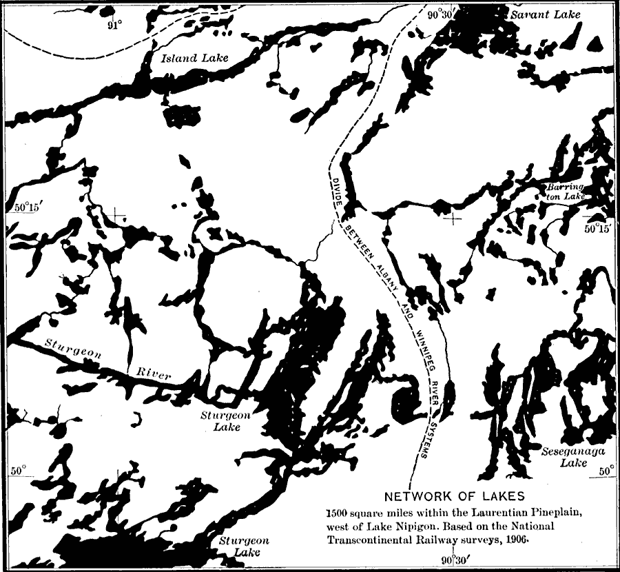
Description: A map from 1911 of a portion of the Laurentian Plateau region of North America showing the drainage and lake network west of Lake Nipigon. The map shows the division line for waters flowing to the Albany and the Winnipeg river systems, and the irregular shape of the lake shorelines and numerous islands typical to the Laurentian landscape. "The topography of the Nipigon area north of Lake Superior is of special interest because the normal erosion features have been either partly masked or greatly complicated by lava flows. To the northeast of Lake Nipigon is the Archæan old–land of crystalline rock containing numerous outliers of sedimentary strata. The southwestern portion of the present basin of Lake Nipigon represents a maturely dissected portion of the inner lowland of the ancient coastal plain." — Bowman, 1911, p. 562.
Place Names: A Regional Map of North America, Canada, �Barrington Lake, �Island Lake, �Albany, �New York, �United States, �Sturgeon Lake, �Savant Lake, �Winnipeg, �Sturgeon Rive
ISO Topic Categories: boundaries,
inlandWaters,
location
Keywords: Drainage on the Laurentian Plateau, physical, �hydrological, kGeology, kGlacial, physical features, drainage basins, boundaries,
inlandWaters,
location, Unknown, 1911
Source: Isaiah Bowman, Ph. D, Forest Physiography (New York, NY: John Wiley and Sons, 1911) 566
Map Credit: Courtesy the private collection of Roy Winkelman |
|