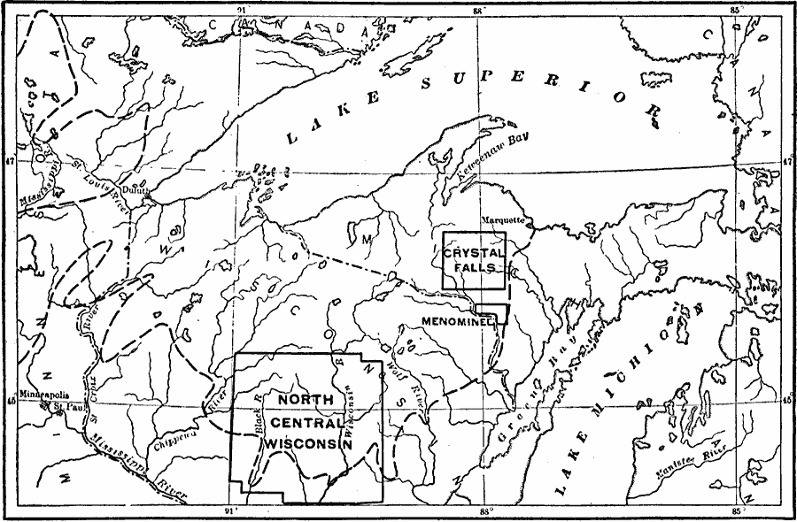
Description: Part of the Great Lakes region. The heavy broken line is the boundary between the Superior Highlands on the north and the Prairie Plains on the south. It is, however, more prominent as a geologic boundary than as a topographic boundary. Note the connection at the west end of Lake Superior between the Superior Highlands and the Laurentian Plateau of Canada. The special districts indicated are portions of the region described in the text.
Place Names: Midwest States, Michigan, �Wisconsin, �Great Lakes Region, �Lake Superior, �Lake Michiga
ISO Topic Categories: boundaries,
inlandWaters,
location
Keywords: Lake Superior and Michigan, physical, physical features,
topographical,
geological, boundaries,
inlandWaters,
location, Unknown, 1911
Source: Isaiah Bowman, Ph. D, Forest Physiography (New York, NY: John Wiley and Sons, 1911) 573
Map Credit: Courtesy the private collection of Roy Winkelman |
|