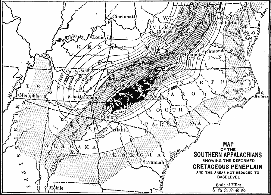
Description: A map from 1911 of the southern Appalachian mountain system showing the deformed Cretaceous Peneplain, and the areas not reduced to base level by wasting. The map is keyed to show the area of the coastal plain, bordering plateaus, the Great Appalachian Valley, and the areas, indicated in black, not reduced to base level. The axes of deformation are represented by the broken lines, AB, CD, EF, GH, and OP. Contour lines represent elevations of restored surface.
Place Names: Eastern States, Memphis, �Atlanta, �Washington D.C., �Savannah, �Mobile, �Cincinnati, �Richmond, �Appalachian Mountains, �Atlantic Ocean, �East Coast, �Gulf of Mexico, �Piedmon
ISO Topic Categories: boundaries,
inlandWaters,
location,
geoscientificInformation
Keywords: The Southern Appalachians, physical, �political, kGeology, physical features,
geological, major political subdivisions, boundaries,
inlandWaters,
location,
geoscientificInformation, Unknown, 1911
Source: Isaiah Bowman, Ph. D, Forest Physiography (New York, NY: John Wiley and Sons, 1911) 593
Map Credit: Courtesy the private collection of Roy Winkelman |
|