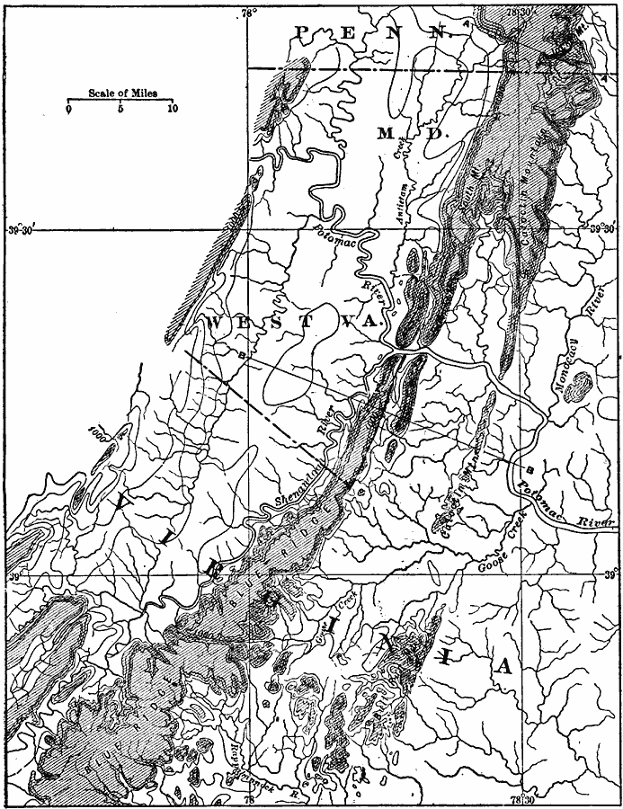
Description: A contour map from 1911 of the southern division of the Older Appalachian mountain system, showing the Blue Ridge, Catoctin Mountain and Bull Run Mountain in Virginia. The blank areas on the map represent Tertiary peneplain, and the shaded areas represent remnants of Cretaceous peneplain now appearing as residuals above the Tertiary level.
Place Names: Atlantic States, Pennsylvania, �Maryland, �West Virginia, �Virginia, �Appalachian Mountains, �Mid-Atlantic States, �Atlantic States, �Blue Ridge, �Shenandoah River, �Potomac Rive
ISO Topic Categories: boundaries,
inlandWaters,
location
Keywords: Southern Division of the Older Appalachians, physical, �political, kGeology, physical features, major political subdivisions, boundaries,
inlandWaters,
location, Unknown, 1911
Source: Isaiah Bowman, Ph. D, Forest Physiography (New York, NY: John Wiley and Sons, 1911) 621
Map Credit: Courtesy the private collection of Roy Winkelman |
|