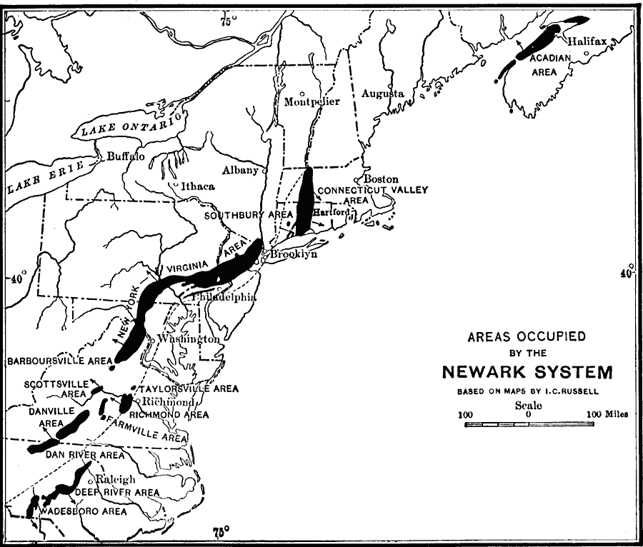
Description: A map from 1911 of the Atlantic slope from the Minas Basin in the Bay of Fundy to the northern boundary of South Carolina showing the Triassic age formation known as the Newark formation of rocks, principally sandstones, shales, and conglomerates. The general distribution of the formation does not occur as a continuous body of rock, but as a series of elongated and detached areas. The map shows the fall–line and indicates the direction of strata dip by arrows.
Place Names: Atlantic States, Philadelphia, �Washington D.C., �Albany, �Boston, �New York, �Appalachian Mountains, �Atlantic Ocean, �Atlantic State
ISO Topic Categories: inlandWaters,
location,
boundaries,
geoscientificInformation
Keywords: Triassic Formation of the Atlantic Slope, physical, �political, kGeology, geological,
physical features, major political subdivisions, inlandWaters,
location,
boundaries,
geoscientificInformation, Unknown, 1911
Source: Isaiah Bowman, Ph. D, Forest Physiography (New York, NY: John Wiley and Sons, 1911) 627
Map Credit: Courtesy the private collection of Roy Winkelman |
|