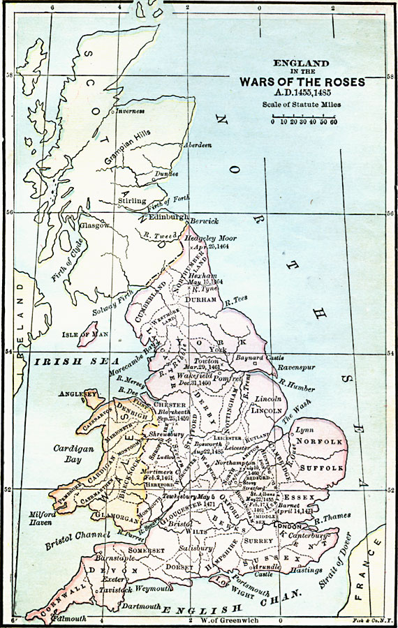
Description: Map of England, Wales, and Scotland during the War of the Roses (1453–1487) between the House of York (White Rose) and the House of Lancaster (Red Rose). This map shows major cities of the time, major river ways, topography, political boundaries, and battlefields (with dates) of the war, including St. Albans (1455), Bloreheath (1459), Northampton (1460), Wakefield (1460), Mortimer's Cross (1461), Towton (1461), Hexham (1464), Barnet (1471), Tewkesbury (1471), and Bosworth Field (1845).
Place Names: United Kingdom, London, �Northhampton, �Bedford, �Bristol, �Glasgow, �Dundee, �Edinboroug
ISO Topic Categories: boundaries,
inlandWaters,
oceans,
location
Keywords: England in the War of the Roses, physical, �political, physical features, major political subdivisions, boundaries,
inlandWaters,
oceans,
location, Unknown, 1455–1485
Source: John J. Anderson, Ph.D., A School History of England (New York, NY: Effingham Maynard and Co., 1889) 146
Map Credit: Courtesy the private collection of Roy Winkelman |
|