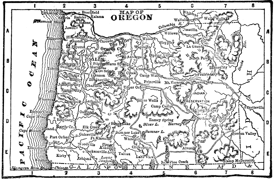
Description: A map from 1898 of Oregon showing the capital of Salem, principal cities and towns, railroads, mountain systems, lakes, rivers, and coastal features. "Oregon, name derived from Spanish word signifying ‘Wild Thyme,’ so called on account of the abundance of the herb found by early explorers. Credit of discovery generally given to Capt. Gray, of Boston, 1792. Organized as a Territory, 1848; admitted 1859." — Edison 1898.
Place Names: Oregon, Oregon City, �Dalles, �Umatilla, �Astoria, �Portland, �Eugene City, �Sale
ISO Topic Categories: boundaries,
inlandWaters,
location,
oceans
Keywords: Oregon, physical, physical features, boundaries,
inlandWaters,
location,
oceans, Unknown, 1898
Source: Thomas F. Edison, Edison's Handy Encyclopaedia of General Information and Universal Atlas (Chicago, IL: Laird and Lee, 1898) 480
Map Credit: Courtesy the private collection of Roy Winkelman |
|