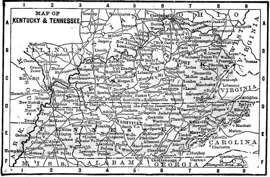
Description: A map from 1898 of Kentucky and Tennessee. "Kentucky — Name Indian. Signifies dark and bloody ground, because the State was the hunting and battle ground of the tribes. Called ‘Corn Cracker State.’ Louisville founded 1780. Earliest explorations made by John Finley and other 1767; Daniel Boone established himself there 1769. Admitted as a State June 1, 1792." "Tennessee — ‘Big Bend State.’ Name derived from ‘Tannassee.’ Indian name for Little Tennessee River. First permanent settlement 1756, on Tennessee River, about 30 miles from present site of Knoxville; first Anglo–American settlement west of the Alleghanies and south of Pennsylvania. Became a part of North Carolina 1777. Organized as the State of Franklin 1785, but again became a part of North Carolina 1788. Ceded to United States by North Carolina 1789. Admitted as a State 1796. Seceded February, 1861; re–admitted 1868." — Edison.
Place Names: Southern States, Nashville, �Knoxville, �Chattanooga, �Memphis, �Troy, �Shelbyville, �Columbia, �Sparta, �Louisville, �Frankfort, �Lexingto
ISO Topic Categories: boundaries,
inlandWaters,
location
Keywords: Kentucky and Tennessee, physical, physical features, boundaries,
inlandWaters,
location, Unknown, 1898
Source: Thomas F. Edison, Edison's Handy Encyclopaedia of General Information and Universal Atlas (Chicago, IL: Laird and Lee, 1898) 491
Map Credit: Courtesy the private collection of Roy Winkelman |
|