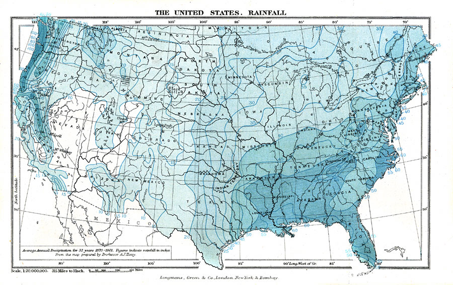
Description: A map from 1904 of the United States, showing the averaged annual rainfall for 32 years (1870–1901) measured in inches per year ranging from under 10 inches to 100 inches. From the map prepared by A.J. Henry.
Place Names: Meteorology, Boston, �Chicago, �Houston, �Los Angeles, �Miami, �New Orleans, �New York, �San Diego, �Seattle, �Washington D.C., �rainfal
ISO Topic Categories: boundaries,
climatologyMeteorologyAtmosphere,
inlandWaters,
oceans
Keywords: The United States: Rainfall, physical, �political, �meteorological, kClimate, kPrecipitation, physical features, country borders,
major political subdivisions,
local jurisdictions, rainfall, boundaries,
climatologyMeteorologyAtmosphere,
inlandWaters,
oceans, Unknown, 1870–1901
Source: Geo. G. Chisholm and C.H. Leete, eds., Longmans' New School Atlas (New York, NY: Longmans, Green, and Co., 1904) 15
Map Credit: Courtesy the private collection of Roy Winkelman |
|