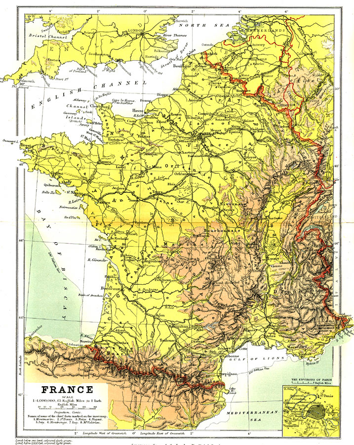
Description: A geo–political map of the France showing country borders current to 1904, major cities, railroad lines, canals and navigable rivers. Physical features include mountain ranges with elevation measured in feet, major rivers and watersheds, and the 100–fathom line in the off–shore waters. Generalized elevations shown as land below sea level feet colored dark green, land below 1,000 feet colored light green, and land above 1,000 feet in elevation colored brown. Battlefields and fortified cities are shown, including an inset of the environs of Paris.
Place Names: France, Bordeaux, �Dunkerque, �Grenoble, �Lyon, �Nice, �Orleans, �Paris, �Nancy, �Tours, �Andor
ISO Topic Categories: boundaries,
elevation,
inlandWaters,
oceans,
transportation
Keywords: France, physical, �political, �transportation, �Conic Projection, �physical features,
topographical, country borders, railroads,
water routes, boundaries,
elevation,
inlandWaters,
oceans,
transportation, Other, 1904
Source: Geo. G. Chisholm and C.H. Leete, eds., Longmans' New School Atlas (New York, NY: Longmans, Green, and Co., 1904) 25
Map Credit: Courtesy the private collection of Roy Winkelman |
|