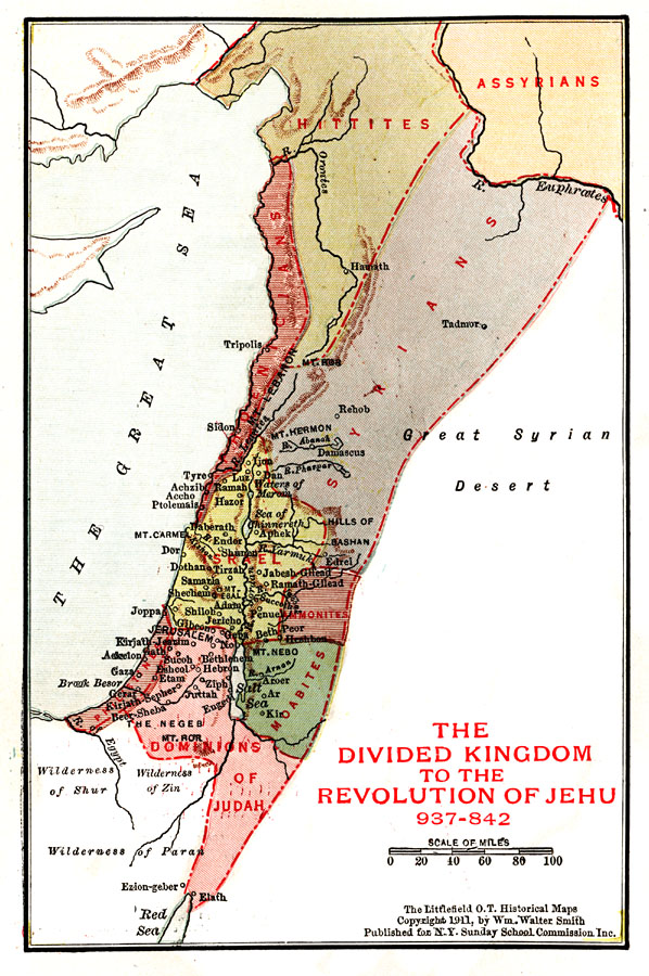
Description: A map of the regions of Palestine from the Divided Kingdom to the Revolution of Jehu (937–842 BC), showing principal cities, mountains, rivers, and the territories of the Hittites, Assyrians, Syrians, Phoenicians, Israel, Ammonites, Moabites, Dominions of Judah, and Philistines.
Place Names: A Regional Map of Asia, Great Sea, �Mediterranean Sea, �Salt Sea, �Dead Sea, �Dominions of Judah, �Israel, �Jerusalem. �Mt. Lebanon, �River Jordan, �Joppa, �Tyre, �Gaza,
ISO Topic Categories: location,
inlandWaters,
boundaries
Keywords: Palestine from the Time of the Divided Kingdom to the Revolution of Jehu, physical, �political, physical features, major political subdivisions, location,
inlandWaters,
boundaries, Unknown, 937–842 BC
Source: William Walter Smith, The Students' Illustrated Historical Geography of the Holy Land (Philadelphia, PA: The Sunday School Times Company, 1911) 65
Map Credit: Courtesy the private collection of Roy Winkelman |
|