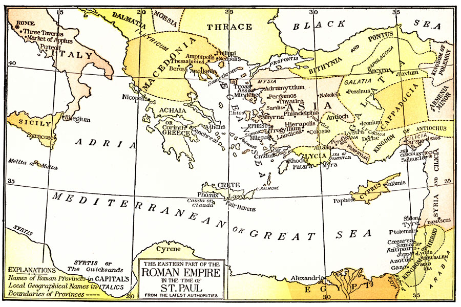
Description: A map of the countries of the Roman Empire bordering on the Mediterranean Sea during the time of St. Paul. The map shows the boundaries of the Roman provinces and principal cities, with the names of the provinces in capital letters.
Place Names: A Regional Map of Asia, Italy, �Sicily, �Dalmatia, �Moesia, �Thrace, �Macedonia, �Achaia, �Greece, �Bithynia, �Pontus, �Galatia, �Cappadocia, �Armenia Minor, �Kingdom of Polemon, �Kingdom of Antiochus, �Pamphylia, �Lycia, �Cyprus, �Syria, �Cilicia, �Kingdom of Herod, �Arabia,
ISO Topic Categories: boundaries,
inlandWaters,
location
Keywords: Eastern Part of the Roman Empire in the Time of St. Paul, physical, �political, physical features, country borders, boundaries,
inlandWaters,
location, Unknown, AD 65
Source: William Walter Smith, The Students' Illustrated Historical Geography of the Holy Land (Philadelphia, PA: The Sunday School Times Company, 1911) 65
Map Credit: Courtesy the private collection of Roy Winkelman |
|