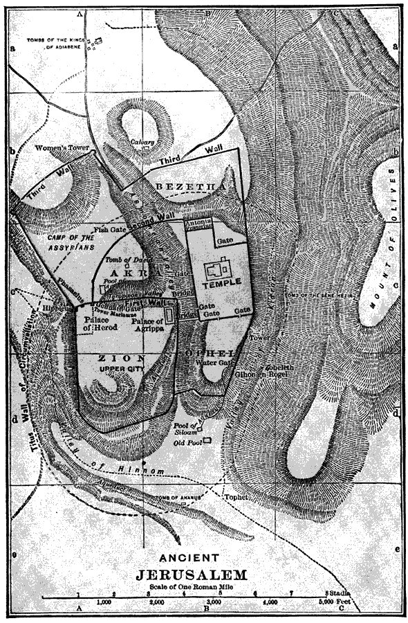
Description: A plan of ancient Jerusalem around AD 100, showing the walls of the city and places of historic interest.
Place Names: Israel, Mount of Olives, �Zion, �Ophel, �Akra, �Bezetha, �Valley of Hinnom, �Calvary,
ISO Topic Categories: location,
structure
Keywords: Ancient Jerusalem, physical, physical features, location,
structure, Unknown, Around AD 100
Source: William Walter Smith, The Students' Illustrated Historical Geography of the Holy Land (Philadelphia, PA: The Sunday School Times Company, 1911) 65
Map Credit: Courtesy the private collection of Roy Winkelman |
|