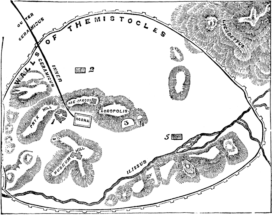
Description: "Athens is situated about three miles from the sea-coast, in the central plain of Attica. In this plain rise several eminences. Of these the most prominent is a lofty insulated mountain, with a conical peaked summit, now called the hill of St. George, and which bore in ancient times the name of Lycabettus. This mountain, which was not included within the ancient walls, lies to the north-east of Athens, and forms the most striking feature in the environs of the city. ... South-west of Lycabettus there are four hills of moderate height, all of which formed part of the city. Of these the nearest to Lycabettus, and at the distance of a mile from the latter, was the Acropolis, or citadel of Athens, a square craggy rock rising abruptly about 150 feet, with a flat summit of about 1000 feet long from east to west, by 500 feet broad from north to south. Immediately west of the Acropolis is a second hill of irregular form, the Areopagus. To the south-west there rises a third hill, the Pnyx, on which the assemblies of the citizens were held; and to the south of the latter is a fourth hill, known as the Meseum."— Smith
Place Names: Greece, Athens, �Theseum, �Walls of Themistocles, �Ilissus, �Lycabettus, �Aoropolis, �Pnyx, �Theatre of Dionysus, �Odeum of Pericles. �Temple of Zeus,
ISO Topic Categories: location,
inlandWaters,
structure
Keywords: Plan of Athens, physical, physical features, location,
inlandWaters,
structure, Unknown,Circa 500 BC
Source: William Smith, A Smaller History of Greece (New York, NY: Harper and Brothers, 1882) 86
Map Credit: Courtesy the private collection of Roy Winkelman |
|