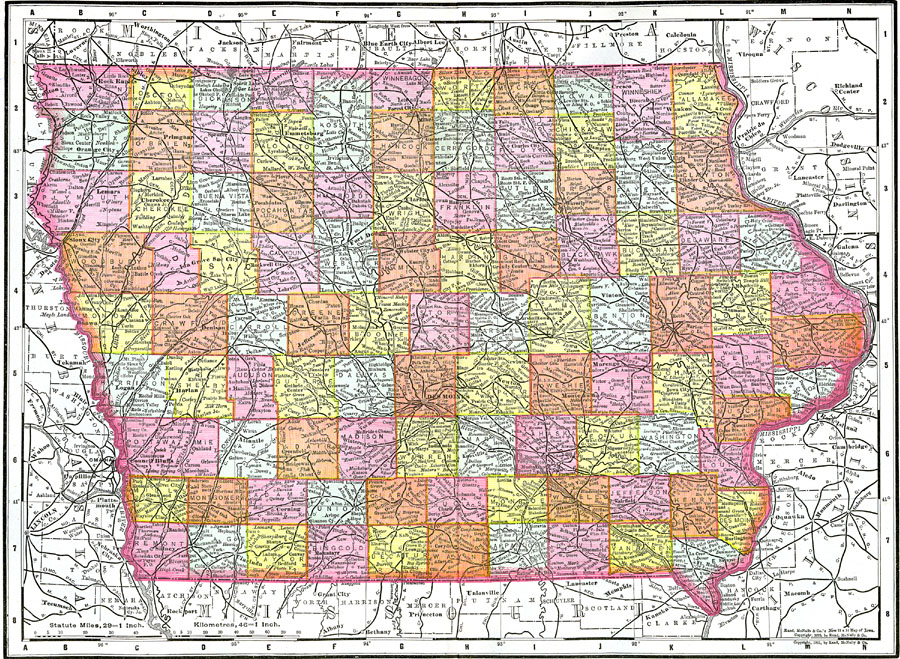
Description: A map from 1903 of Iowa showing the State capital of Des Moines, counties and county seats, major cities and towns, railroads, and rivers, including the border rivers of the Mississippi and Missouri.
Place Names: Iowa, Cedar Falls, �Clinton, �Creston, �Des Moines, �Dubuque, �Hamburg, �Iowa City, �Mason, �Sioux City, �Waterlo
ISO Topic Categories: oceans,
location,
inlandWaters
Keywords: Iowa, physical, �political, �transportation, county borders, roads, oceans,
location,
inlandWaters, Unknown, 1903
Source: Spencer Baynes, LL.D., and W. Robertson Smith, LL.D., eds., The Encyclopedia Britannica vol. 13 (New York, NY: The Werner Company, 1903)
Map Credit: Courtesy the private collection of Roy Winkelman |
|