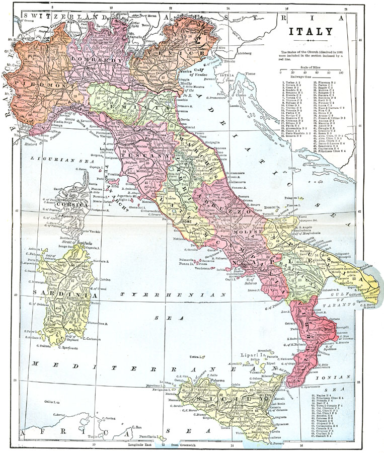
Description: A map of Italy in 1903 showing cities, railways, rivers, mountain systems, and the Compartments of the country. The States of the Church (dissolved in 1870) are shown enclosed by a red line. A reference key shows grid locations for major cities.
Place Names: Italy, Abbruzzo, �Bologna, �Calabria, �Corsica, �Florence, �Genoa, �Lombardy, �Messina, �Milan, �Naples, �Nicotera, �Piedmont, �Pisa, �Rome, �Sardinia, �Sicily, �Tuscany, �Umbria, �Venice, �Veron
ISO Topic Categories: oceans,
location,
inlandWaters
Keywords: Italy, physical, �political, county borders, oceans,
location,
inlandWaters, Unknown, 1903
Source: Spencer Baynes, LL.D., and W. Robertson Smith, LL.D., eds., The Encyclopedia Britannica vol. 13 (New York, NY: The Werner Company, 1903)
Map Credit: Courtesy the private collection of Roy Winkelman |
|