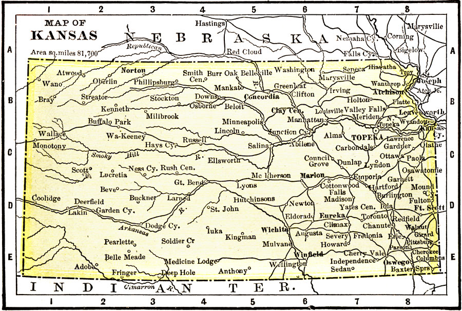
Description: A map from 1904 of Kansas showing the State capital of Topeka, major cities and towns, railroads, and rivers. "Kansas (Garden of the West) — Organized as a Territory in 1854; made a State in 1861. Area, 82,080 square miles; population, 1,477,000. Agriculture and stock raising are the leading pursuits of the State. The manufacture of meat products is of chief importance, and Kansas City is the second largest meat packing city in the country. Flour and grist mill products rank second in importance. Wheat culture is extensive. The smelting and reefing of zinc has become of the important industries of the State. The salary of the Governor is $3,000." — Wark 1904.
Place Names: Kansas, Wichita, �Topeka, �Atchinson, �Dodge City, �Junction, �Leavenworth, �Kansas Cit
ISO Topic Categories: transportation,
society
Keywords: Kansas, physical, �political, �transportation, physical features, major political subdivisions, railroads, transportation,
society, Unknown, 1904
Source: Henry Wark, ed. , Wark's Modern Educator (New York, NY: Henry Wark, 1904) 877
Map Credit: Courtesy the private collection of Roy Winkelman |
|