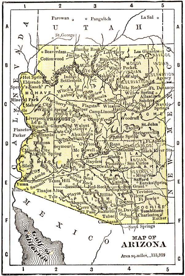
Description: A map of Arizona from 1904. "Arizona was organized as a territory in 1863. Area, 112,290 square miles; population, 122,212. Of these 26,480 are Indians. About one–third of the white population are foreign born. Chiefly a mining Territory but beginning to take rank as an agricultural country owing to extension of irrigation. Copper smelting and refining is the chief industry. The number of acres under irrigation is 558,821. The staple crops of the Territory are alfalfa, corn, wheat, barley, root crops, vegetables, and fruits. Stock raising is proving very successful. The Territory claims on of the best public school systems in the United States. A bill to admit Arizona to statehood passed the House in 1902 but was shelved by the Senate. Ranks second in copper, sixth in gold, forty-ninth in population, and forty-fourth in wealth." &mdash Wark 1904.
Place Names: Arizona, Phoenix, �Prescott, �Tombstone, �St. John, �Yum
ISO Topic Categories: transportation,
society
Keywords: Arizona, physical, �political, �transportation, physical features,
topographical, country borders,
major political subdivisions,
county borders, railroads, transportation,
society, Unknown, 1904
Source: Henry Wark, ed. , Wark's Modern Educator (New York, NY: Henry Wark, 1904) 880
Map Credit: Courtesy the private collection of Roy Winkelman |
|