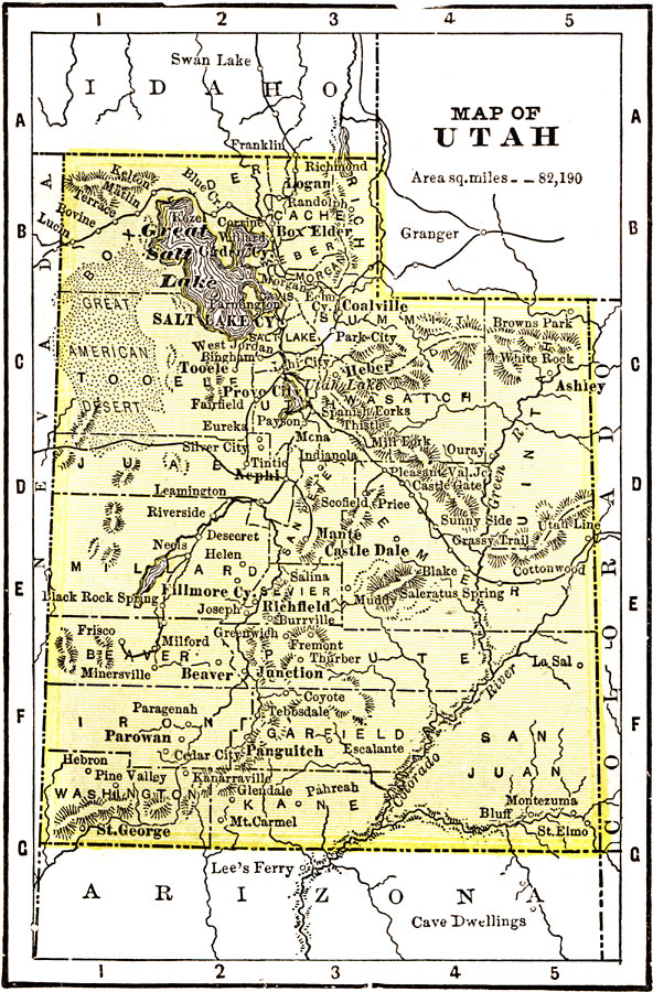
Description: A map from 1904 of Utah showing the capital at Salt Lake City, counties and county seats, principal cities and towns, railroads, mountains, rivers, and the Salt Lake desert region. "Utah was organized as a Territory in 1850. Area, 84,970 square miles; population, 283,000. Admitted as a State in 1896. In 1847 the Mormons commence to make settlements in Salt Lake Valley and rapidly spread themselves over the entire Territory. Primarily a mining and agricultural State. The smelting and refining of lead ore is the most important industry. The manufacture of salt ranks high in the scale of important industries. Flour and grist milling, the canning of fruits and vegetables, the manufacture of beet sugar, malt liquors, and of butter and cheese are all of importance. The State ranks fortieth in wealth, seventh in gold, fourth in copper. The Governor receives a salary of $2,000." — Wark, 1904.
Place Names: Utah, Salt Lake City, �Fillmore, �Prove City, �Castle Dale, �Box Elde
ISO Topic Categories:
Keywords: Utah, Unknown, 1904
Source: Henry Wark, ed. , Wark's Modern Educator (New York, NY: Henry Wark, 1904) 880
Map Credit: Courtesy the private collection of Roy Winkelman |
|