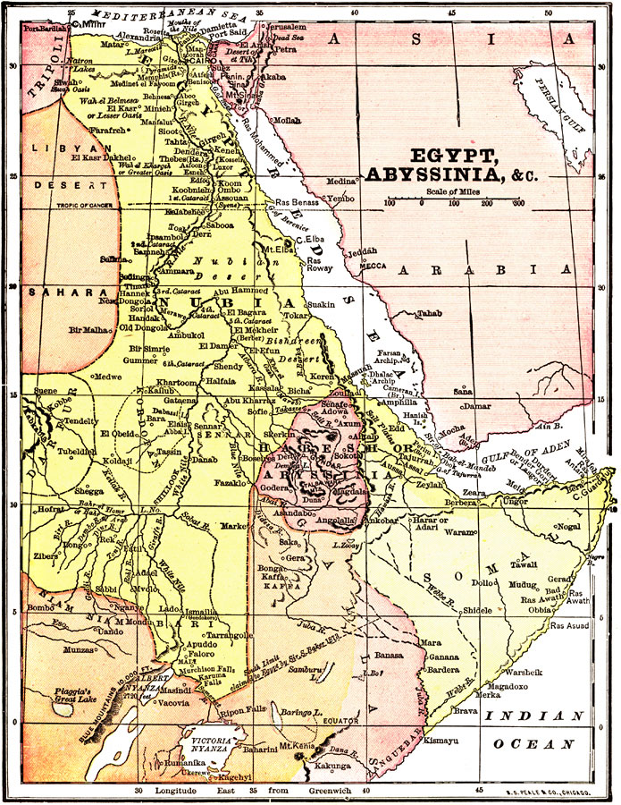
Description: "Egypt is another of those countries whose prehistoric ages are wrapped in mystery as impenetrable as the sources of her Nile, whose exact location ling baffled the most enterprising of explorers. Great interest attaches to the country's early annals, but the stories of the dynasties which succeeded Menes, the founder of Memphis, of the rule of the Pharaohs, and the Ptolemies and the Cleopatras, though pregnant with true historical interest, cannot here be told, and it will suffice to quote the language of a graceful historian, who wrote: 'It (Egypt) attained a high position for wealth and the institutions of civilized society when all the surrounding countries dwelt in the darkness of barbarism. It had a well organized and efficient government long before the national greatness of the Hebrews.' Moslem rule prevailed in the country after their conquest of it in 639. The Caliphs were expelled by the Turcomens, who gave way before the Mamelukes in 1250, whose rule continued until 1517, when Selim, Sultan of Turkey, put an end to their dominion and organized the land as a dependency of Turkey. For over two centuries the descendants of the vanquished Mameluke chieftains opposed the Turks. A descent upon Egypt was made by the French under Napoleon in 1798, but the Mamelukes were not overcome until the treacherous massacre of their leaders established the Pasha in quiet upon his viceregal throne. ...Nominally Egypt is a province of the Turkish Empire, although actually it is autonomous under the Khedive, being subject only to the tribute of $3,600,000 payable annually to the Sultan; and yet at the same time it is dependent for its existence upon the till of the European Powers, Great Britain being the dominant factor in the control of its internal affairs." — Wark 1904 This map produced by R.S. Peale & Co., Chicago 1904.
Place Names: A Regional Map of Africa, Harar, �Arabia, �Somalia, �Habesh, �Nubia, �Sahara, �Darfur, �Cairo, �Red Se
ISO Topic Categories: society
Keywords: Egypt, Abyssinia, et cetera, physical, �political, physical features,
topographical, country borders, society, Unknown, 1904
Source: Henry Wark, ed. , Wark's Modern Educator (New York, NY: Henry Wark, 1904) 942
Map Credit: Courtesy the private collection of Roy Winkelman |
|