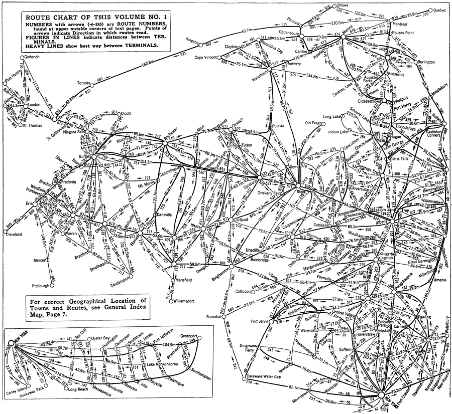
Description: A map from the 1920 Automobile Club of Rochester showing automobile routes of New York and vicinities to the north. The map shows route numbers, mileages and terminals only. The inset map shows the automobile routes between New York City and Greenport on Long Island.
Place Names: A Regional Map of North America, Canada, �United States, �New York, �Vermont,
ISO Topic Categories: location,
transportation
Keywords: Automobile Routes of New York and Vicinities to the North, physical, �transportation, kAutomobile, physical features, roads, location,
transportation, Unknown,1920
Source: , Automobile Club of Rochester (New York, NY: The Automobile Club of Rochester, 1920) 4
Map Credit: Courtesy the private collection of Roy Winkelman |
|