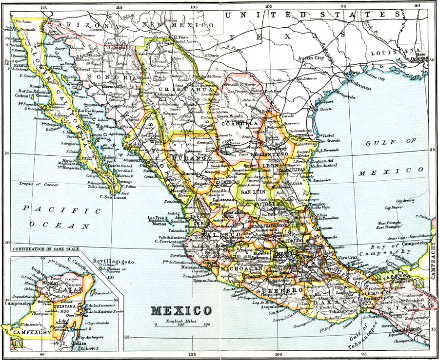
Description: A map from 1911 of Mexico showing the states, major cities and towns, railroads, mountains, rivers, lakes, and coastal features of the country. An inset map shows the continuation of the Yucatan Peninsula at the same map scale.
Place Names: Mexico, Mexico City, �Durango, �Chihuahua, �Sonora, �Sinaloa, �San Luis, �Coahuila, �Tamaulipas, �Michoacan, �Guerrero, �Oaxaca, �Vera Cruz, �Chiapa
ISO Topic Categories: structure,
transportation
Keywords: Mexico, political, �transportation, country borders,
major political subdivisions, railroads, structure,
transportation, Unknown, 1911
Source: Ernest Rhys, Ed., A Literary and Historical Atlas of North & South America (New York, NY: E.P. Dutton & CO., 1911) 76
Map Credit: Courtesy the private collection of Roy Winkelman |
|