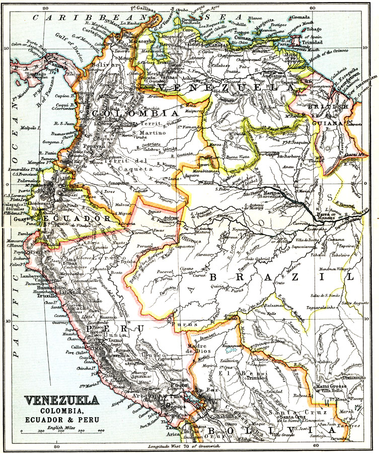
Description: A map from 1911 showing the political boundaries of Venezuela, British Guiana, Columbia, Ecuador, and Peru at the time, and includes the frontiers of Panama, Brazil, and Bolivia. The map shows major cities, ports, and settlements, railways, rivers, terrain, and coastal features.
Place Names: A Regional Map of South America, Columbia, �Venezuela, �Peru, �Ecuado
ISO Topic Categories: society
Keywords: Venezuela, Colombia, Ecuador and Peru, political, country borders,
major political subdivisions, society, Unknown, 1911
Source: Ernest Rhys, Ed., A Literary and Historical Atlas of North & South America (New York, NY: E.P. Dutton & CO., 1911) 90
Map Credit: Courtesy the private collection of Roy Winkelman |
|