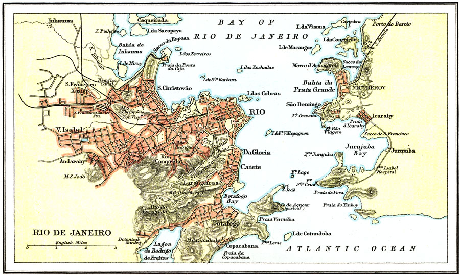
Description: A map from 1911 of the environs of Rio de Janeiro, capital of Brazil at that time. The map shows the southern portion of the Bay of Rio de Janeiro and terrain, including the famous Pão de Açucar (Sugarloaf), major thoroughfares, railways and stations, hospital, churches, forts, and harbor area. The barrios and, at that time, neighboring cities of Sã:o Cristovão, Da Gloria, Botafogo, Copacabana, Vila Isabel, Rio Comprido, Nictheroy, São Domingo, and Icarahy, are shown.
Place Names: Brazil, Brazil, �Rio de Janeiro, �Ri
ISO Topic Categories: society
Keywords: Rio de Janeiro, physical, physical features,
topographical, society, Unknown, 1911
Source: Ernest Rhys, Ed., A Literary and Historical Atlas of North & South America (New York, NY: E.P. Dutton & CO., 1911) 94
Map Credit: Courtesy the private collection of Roy Winkelman |
|