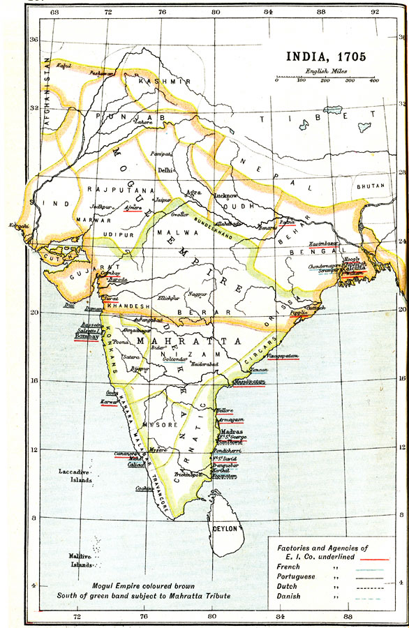
Description: A map of the Indian subcontinent in 1705 at the height of the Mogul Empire and the expansion of the British East India Company's holdings in the region. This map is color-coded to show those regions and provinces of India under the Mogul Empire, outlined in brown, and those of the Mahratta (Mahratha) Empire or subject to Mahratta tribute in green. The factories and agencies of the East India Company located in India are underlined in red, with cities, ports, and trade centers under French, Portuguese, Dutch, or Danish control denoted by respective underlined names.
Place Names: Southern Asia, India, �Nepal, �Tibe
ISO Topic Categories: society
Keywords: India, political, �historical, society, Unknown, 1705
Source: Ernest Rhys, Ed., A Literary and Historical Atlas of Asia (New York, NY: E.P. Dutton & CO., 1912) 18
Map Credit: Courtesy the private collection of Roy Winkelman |
|