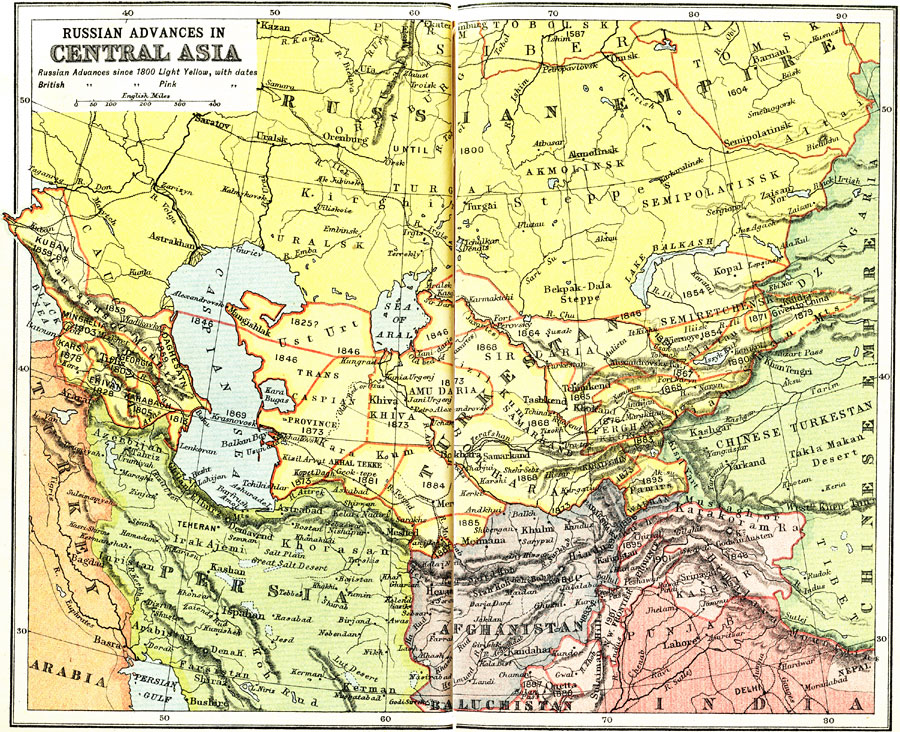
Description: A map from 1912 of Central Asia showing the expansions of the Russian Empire and Britain in the region between 1800 and 1912. The map is color–coded to show the territories of Russia and Britain in 1800, and the advances south of the Russian Empire in light yellow and the advances of the British Territory beyond India in light pink. The dates of territorial claims are shown. The map includes major cities, railroads, rivers, and terrain features of the region.
Place Names: Central Asia, Russia, �Turkey, �Persia, �Afghanistan, �Turkestan, �Indi
ISO Topic Categories: society
Keywords: Russian and British Expansion in Central Asia, historical, �political, major political subdivisions,
country borders, society, Unknown, 1800–1912
Source: Ernest Rhys, Ed., A Literary and Historical Atlas of Asia (New York, NY: E.P. Dutton & CO., 1912) 24
Map Credit: Courtesy the private collection of Roy Winkelman |
|