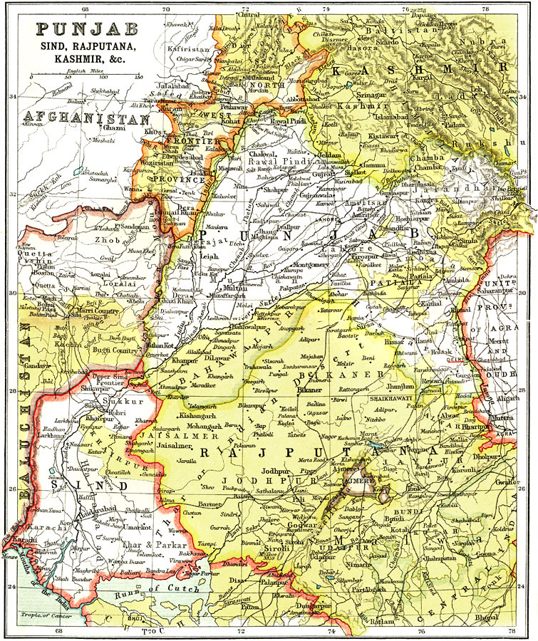
Description: A map from 1912 of the British provinces of Punjab, Sind, Rajputana and Kashmir in India. The map shows the frontier with Baluchistan and Afghanistan, major cities, railways, rivers, and terrain of the region.
Place Names: India , Sind, �Punjab, �Kashmir, �Rajputan
ISO Topic Categories: society
Keywords: Punjab, Sind, Rajputana, Kashmir, political, �historical, country borders,
major political subdivisions, society, Unknown, 1912
Source: Ernest Rhys, Ed., A Literary and Historical Atlas of Asia (New York, NY: E.P. Dutton & CO., 1912) 58
Map Credit: Courtesy the private collection of Roy Winkelman |
|