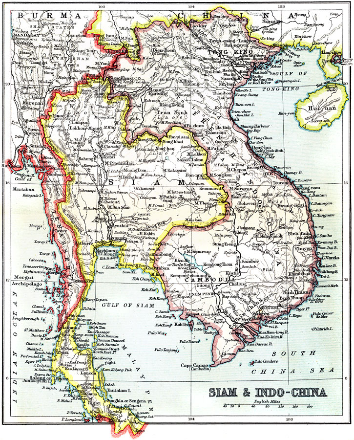
Description: A map from 1912 of the political boundaries of the time for the countries of Siam (Thailand), and French Indochina (Vietnam, Cambodia and Laos). These boundaries were established by the Anglo–French agreement (Entente cordiale) of 1904. The map shows the Siamese territory from the West Laos province in the north to the British Straits Settlements on the Malay Peninsula, the French possessions of Tong&ndashKing, Annam, Laos, Cambodia, and Cochin China, as well as the frontiers of China and British Burma. The map shows province boundaries, major cities and ports, railroads, lakes, rivers, terrain, coastal features, and islands of the region.
Place Names: Southeastern Asia, Thailand, �Siam, �Indochina, �Burma, �Cambodi
ISO Topic Categories: society
Keywords: Siam and Indo-China, political, �physical, physical features, country borders, society, Unknown, 1912
Source: Ernest Rhys, Ed., A Literary and Historical Atlas of Asia (New York, NY: E.P. Dutton & CO., 1912) 70
Map Credit: Courtesy the private collection of Roy Winkelman |
|