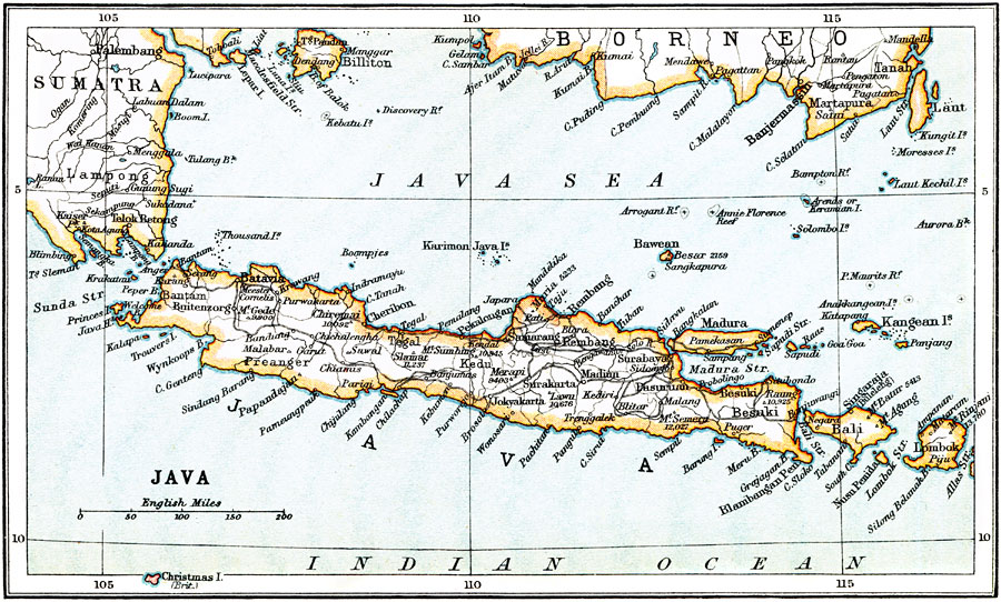
Description: A map from 1912 of the island of Java, with the neighboring islands of Bali, Lombok, and smaller islands of the Java Sea. The map also shows the eastern portion of Sumatra and southern portion of Borneo. Major cities and ports, volcanoes with elevations given in feet, terrain, and coastal features of the island are shown.
Place Names: Java, Batavia, �Joyakarta, �besuki, �Bali, �Madura, �Remban
ISO Topic Categories: society
Keywords: Java, political, �physical, physical features, country borders, society, Unknown, 1912
Source: Ernest Rhys, Ed., A Literary and Historical Atlas of Asia (New York, NY: E.P. Dutton & CO., 1912) 76
Map Credit: Courtesy the private collection of Roy Winkelman |
|