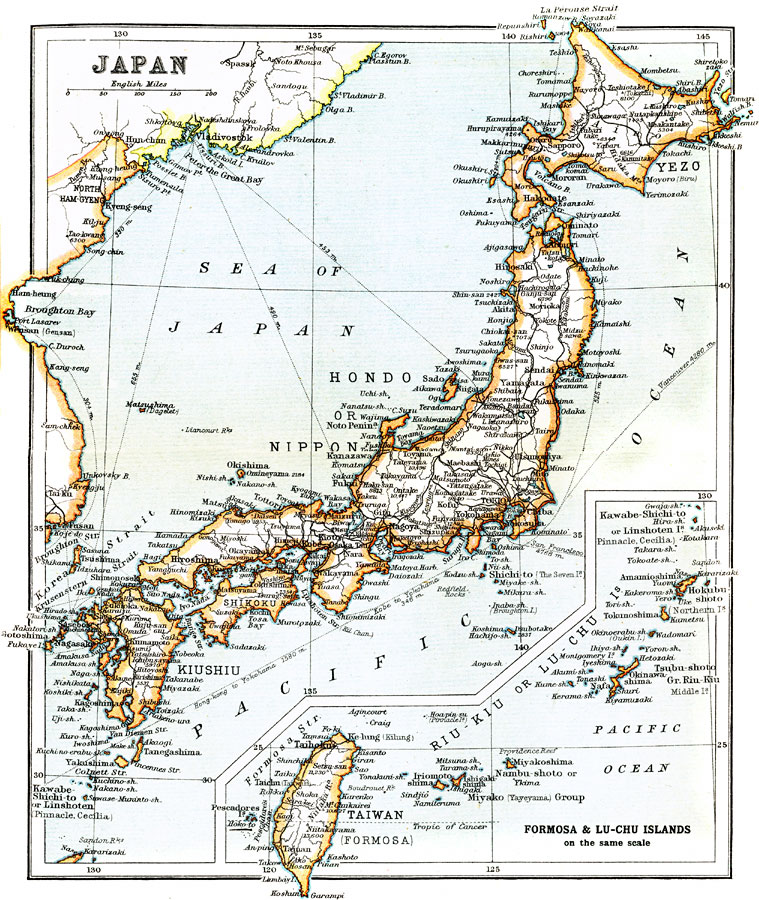
Description: Composed of more than 3000 islands, Japan extends along the Pacific coast of Asia. The inset map of Taiwan, sometimes referred to as Formosa, is pictured because Taiwan was a Japanese territory after being ceded from China in the late 19th century.
Place Names: Japan, Tokyo, �Yokohama, �Nagoya, �Hiroshima, �Fukuoka, �Akita, �Kobe, �Osaka, �Sapporo, �Senda
ISO Topic Categories: society
Keywords: Japan, physical, �transportation, �political, physical features, country borders, railroads, society, Unknown, 1912
Source: Ernest Rhys, Ed., A Literary and Historical Atlas of Asia (New York, NY: E.P. Dutton & CO., 1912) 88
Map Credit: Courtesy the private collection of Roy Winkelman |
|