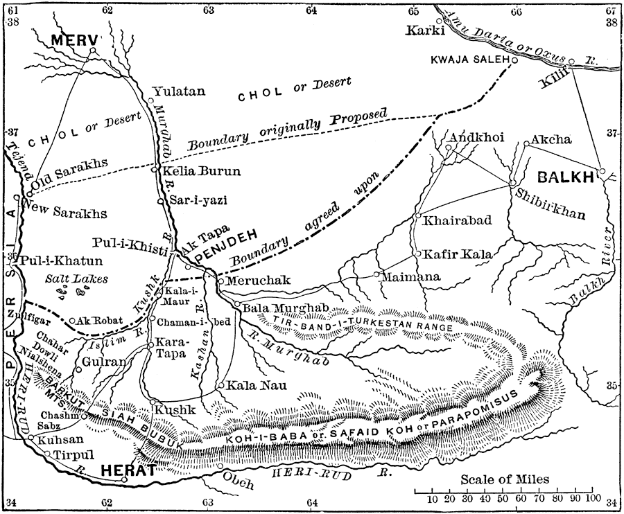
Description: A map showing the border dispute (circa 1856 to 1883) between Russia and Afghanistan in the frontier region situated west to east between the Tejend River (Heri-rud) and the Oxus River (Amu Darya), and north to south between the cities of Merv (Russia) and Heart (Afghanistan). The map shows both the proposed boundary north of Kelia Burun on the Murghab River and the agreed upon boundary just south of Penjdeh.
Place Names: Afghanistan, Balkh, �Karki, �Penjdeh, �Merv, �Herat, Heri-rud River, �Tir-Band-I-turkestan Range, �River Murghab,
ISO Topic Categories: boundaries,
inlandWaters,
society
Keywords: The New Russian-Afghan Frontier, physical, �political, physical features,
topographical, country borders, boundaries,
inlandWaters,
society, Unknown, 1886
Source: William Simpson, Harper's New Monthly Magazine (New York, NY: Harper & Brothers, 1886) 620
Map Credit: Courtesy the private collection of Roy Winkelman |
|