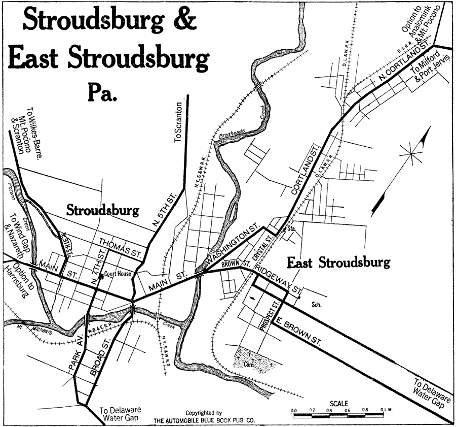
Description: A road map of Stroudsburg and East Stroudsburg, Pennsylvania, from the Automobile Club of Rochester (1920) showing the principal roads, railroads and station, bridges, and major landmarks.
Place Names: Pennsylvania, Stroudsburg, �East Stroudsburg, �Brodheads Creek, �Mt. Michaels Creek, �Pocono Creek,
ISO Topic Categories: location,
inlandWaters,
transportation
Keywords: Stroudsburg and East Stroudsburg, Pennsylvania, physical, �transportation, kAutomobile, physical features, roads,
railroads, location,
inlandWaters,
transportation, Unknown,1920
Source: , Automobile Club of Rochester (New York, NY: The Automobile Club of Rochester, 1920) 347
Map Credit: Courtesy the private collection of Roy Winkelman |
|