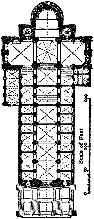
Description: This is a plan of the Cathedral of Spires (Speyer), Germany. It is an example of Romanesque and Gothic architecture in Germany. The scale is in feet. Construction lasted from 1030 to 1061, and it was planned by Conrad II. In Germany and Italy up until this point in architecture open timber roofing or flat ceilings were being used, however this problem was "solved in Germany, as well as in Italy, [with the] vaulting over the nave, and the cathedrals of Spires, Worms and Mainz are the three most important churches in which this was accomplished,"
Place Names: Germany, Plan of Cathedral of Spire
ISO Topic Categories: structure
Keywords: Plan of Cathedral of Spires, historical, �architecture, kArchitecture, structure, Unknown, 1030–1061
Source: , The Enctclopædia Britannica a Dictionary of Arts, Sciences, Literature and General Information Eleventh Edition Volume II Andros to Austria (New York, NY: The Encyclopædia Britannica Company, 1910) 405
Map Credit: Courtesy the private collection of Roy Winkelman |
|