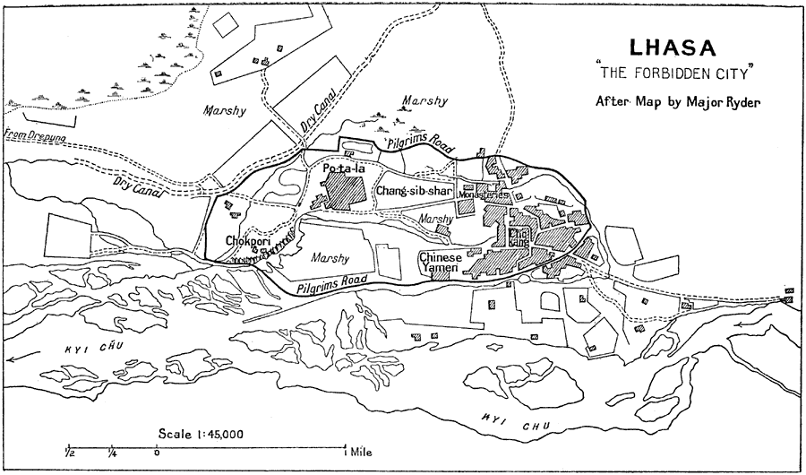
Description: A map from 1912 of the Tibetan capital city of Lhasa, showing the pilgrim route to circumambulate the sacred Chokang (Johkhang) Temple, the Po–ta–la Palace, the sacred hill Chokpori, the Chinese Yamen (office of the Chinese Empire), Chang–sib–shar, and Buddhist monasteries. The map also shows the roads to Lhasa, dry canals, marshy areas, and the Kyi Chu River.
Place Names: China, Lhas
ISO Topic Categories: society
Keywords: Lhasa Tibet, historical, �transportation, roads,
water routes, society, Unknown, 1912
Source: Ernest Rhys, Ed., A Literary and Historical Atlas of Asia (New York, NY: E.P. Dutton & CO., 1912) 144
Map Credit: Courtesy the private collection of Roy Winkelman |
|