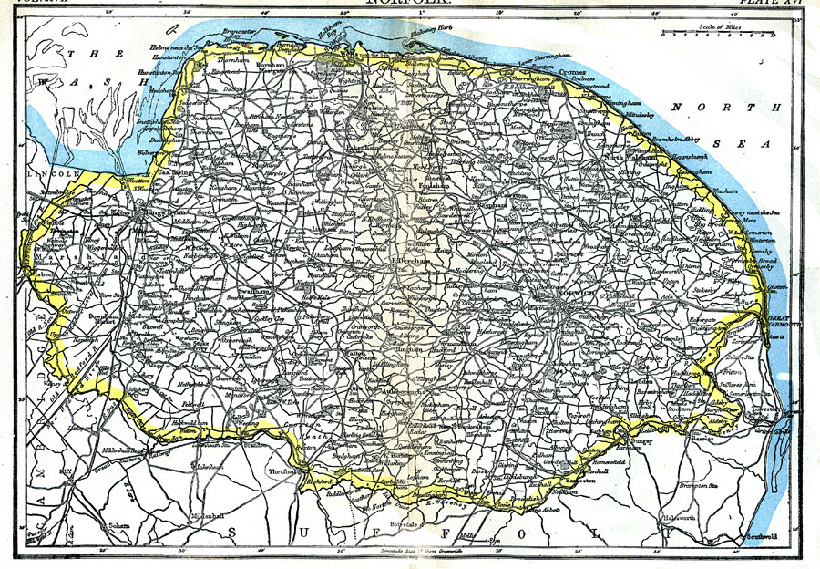
Description: A map of the English county of Norfolk showing cities and the transportation network. "Norfolk, an eastern maritime county of England, is bounded N. and E. by the North Sea, S.E. and S. by Suffolk, S.W. by Cambridge, and W. by Lincoln. It is of an irregular oval form, its greatest length east and west being 67 miles, and its greatest breadth about 42 miles. The area is 1,356,173 acres, or 2119 square miles." —Kellogg, 1903
Place Names: United Kingdom, Norfolk, �North Sea, �Kings Lynn, �Thetford, �Norwich,
ISO Topic Categories: transportation,
inlandWaters,
oceans,
boundaries
Keywords: Norfolk, physical, �political, �transportation, physical features, county borders, railroads,
roads, transportation,
inlandWaters,
oceans,
boundaries, Unknown,1903
Source: Day Otis Kellogg, Encyclopædia Britannica Vol. XVII (New York, NY: Werner Company, 1903) 536
Map Credit: Courtesy the private collection of Roy Winkelman |
|