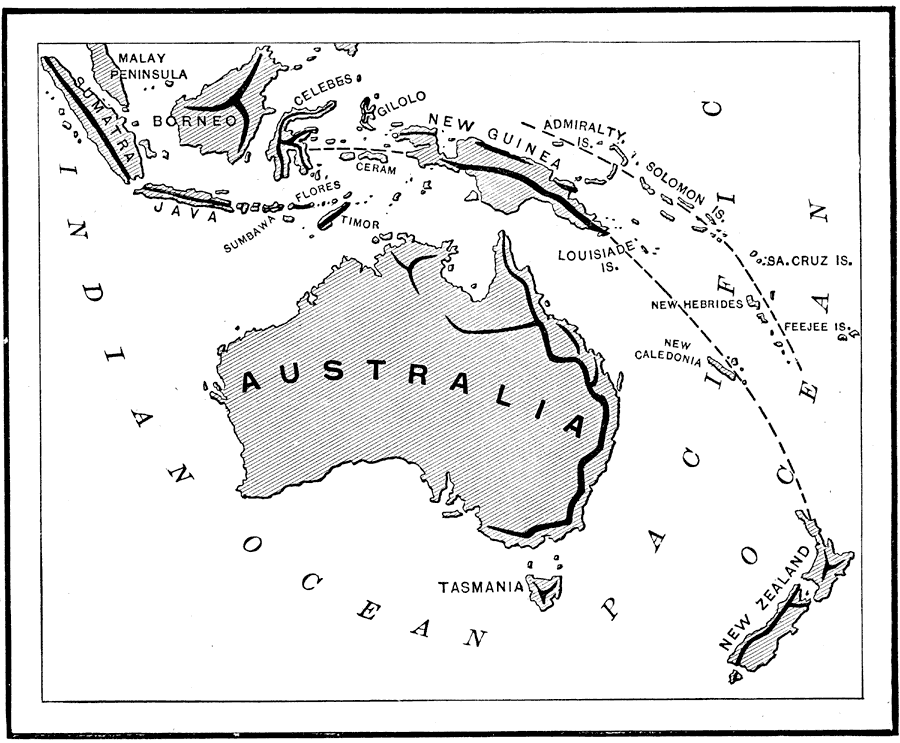
Description: A map from 1890 showing the Australasian chain of islands from the Malay Peninsula to New Zealand. "The Australasian Chain sweeps in a double curve from the Sunda Islands to New Zealand, and consists of a number of parallel island-ranges. (a). The Sunda Islands, curving from northwest to east, and including Sumatra, Java, Sumbawa, Flores, etc. (b). Ceram, New Guinea, and the Louisiade Archipelago, trending nearly northwest and southeast. In their continuation lie New Caledonia and Loyalty Islands. (c). The Admiralty, Solomon, Santa Cruz, and New Hebrides islands having the same trend as the preceding chain, and accompanying it on the northeast. (d). New Zealand, the southeastern terminus of the Australasian chain. Its northern end points toward New Caldonia, but the greater part curves southwest and is parallel to the coast of the Australian continent. Tasmania is a direct continuation of the principal chain of the Australian mountains." — Brewer, 1890, p.41.
Place Names: A Complete Map of Australia, Australia, �Federated States of Micronesia, �French Polynesia, �Indonesia, �Kiribati, �Marshall Islands, �New Zealand, �Papua New Guinea, �Solomon Islands, �Malay Peninsula, �Sumatra, �Java, �Borneo, �Celebes, �Gilolo, �Sumbawa, �Flores, �Timor, �Cera
ISO Topic Categories:
Keywords: Australasian Island Chain, physical, �island formation, �physical features, Unknown, 1890
Source: William H. Brewer Ph.,D., Warren's New Physical Geography (Philadelphia, PA: Cowperthwait and Company, 1890) 41
Map Credit: Courtesy the private collection of Roy Winkelman |
|